Downtown Zoning Code Reform
What's Happening?
The City of Ukiah is proposing a General Plan amendment and rezoning to address long-standing implementation challenges across areas designated under the Downtown Zoning Code (DZC) and implement key policies and goals of the 2040 General Plan. These changes reflect more than a decade of applying the DZC regulations to encourage new development, particularly along the Perkins Street corridor, and incorporate additional recommendations from the DZC Reform Ad Hoc Committee.
The proposed actions are intended to better align the City’s zoning regulations with existing parcel conditions, development patterns, and public investments by State agencies. In general, the effort focuses on rezoning the Perkins Street corridor out the DZC, while expanding the DZC along the eastern and southern portions of its current boundaries.
What is the DZC?
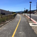
The Downtown Zoning Code is a form-based zoning framework adopted in 2012 following years of community visioning, public workshops, as well as Planning Commission and City Council review. It applies to most of downtown Ukiah and much of the East Perkins Street corridor. It was intended to promote walkability, mixed-use development, and coordinate urban design on private parcels.
While the DZC has successfully informed public improvements and streetscape projects, private redevelopment and adaptive reuse have been sporadic and limited. Project review since adoption indicates that the DZC’s regulatory structure, standards, and boundaries are not resulting in new development or adaptive reuse efficiently. This has resulted in needed exceptions for development proposals that are received, expectations for the need for discretionary review, and uncertainty for applicants.
Why Rezone?
Rezoning is recommended to address the mismatch between the form-based zoning standards and the physical characteristics of many parcels within the DZC designated areas. Along Perkins Street in particular, parcels tend to be larger, irregularly shaped, and oriented toward auto-dependent uses. Applying uniform form-based standards without the corresponding street network, strong existing design examples, or effective site layout, has constrained development opportunities and resulted in only a single new structure in the DZC along the Perkins Street corridor. Reassigning these areas to existing zoning districts used elsewhere in the City allows development to be reviewed under objective standards that better respond to various parcel sizes, layouts, and existing improvements, while still supporting mixed-use and residential opportunities consistent with General Plan goals.
Rezoning also address recent State agencies investments as Public Facilities, particulaly the state courthouse, presently under construction, and areas now under the purview of the Great Redwood Trail Agency.
Why Perkins Street?
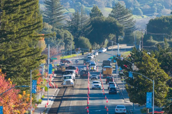
The Perkins Street corridor differs substantially from the traditional downtown core of Ukiah. It developed with larger parcels, deeper setbacks, and auto-oriented circulation patterns, with many properties transitioning from agricultural to commercial uses following construction of US 101, most notably the Pear Tree Center in 1977. Although early DZC planning assumed more comprehensive street extensions and infrastructure investment, many of those improvements were not implemented following the dissolution of redevelopment agencies. As a result, the corridor has been regulated since 2012 under a zoning framework that does not align with its physical or functional context. Rezoning Perkins Street into a more adaptable commercial district restores previous zoning districts, reduces reliance on exceptions, and provides a clearer path for reinvestment, parcel consolidation, and incremental improvement, even though it does not functionally allow for substantially different or more intensive use.
The rezoning also more appropriately categorizes recent public improvements and acquisitions, including the Mendocino County Courthouse and facilities associated with the Great Redwood Trail Agency.
Why increase the DZC boundaries?
The DZC currently applies a design based approach across areas with very different parcel structures, frontage conditions, and development histories. Boundary adjustments allow the City to concentrate form-based controls in locations where they are most effective, such as State Street and adjacent corridors that share a traditional block pattern, like Seminary Avenue. Expanding the DZC into areas such as Oak Street and Seminary Avenue, while removing misaligned parcels along Perkins Street, reflects the DZC Ad Hoc Committee’s recommendation to evaluate each area on its own terms. It also allows for the DZC to stretch across streets, and allow for more effective project coordination. This approach supports General Plan Policy LU-3 by strengthening downtown character where it exists and removing unnecessary constraints where it does not.
Relevant Environmental Studies
- (2008) Form Based’ SmartCode District and ALUC Implications - Memorandum
- (2012) Ukiah Courthouse - Final Environmental Impact Report - SCH # 2011042089
- (2012) Ukiah Courthouse - Appendix A - SCH # 2011042089
- (2012) Downtown Zoning Code Final EIR - SCH #2012062026
- (2022) Addendum to the New Ukiah Courthouse Environmental Impact Report
Planning Commission - DZC Ad Hoc Update (12/10/2025)
- Meeting Video
- Staff Report
- Presentation – Planning Commission Hearing
- Downtown Zoning Code Overview Presentation – 2011
- Downtown Zoning Code Ordinance No. 1139 – 2012
- Downtown Zoning Code – Maps, Figures & Parcels – 2025
- Downtown Zoning Code – Alternative Regulating Plan – 2009
- Downtown Zoning Code Map – Proposed
Planning Commission - Rezone & GPA: Project Update (02/25/26)
Airport Land Use Commission (ALUC) - TBD
- Meeting Video – TBD
- Mendocino County ALUC Agenda – TBD
- City of Ukiah Cover Letter