
Ukiah Gateways
Why does Ukiah prioritize Gateways?
The Ukiah community has long recognized gateways as important contributors to community identity and first impressions. The concept of gateway signage in the Ukiah Valley dates back to the early 20th century, particularly the 1930s, when communities along the U.S. 101 corridor north of San Francisco promoted themselves as a “Gateway to the Redwoods.”
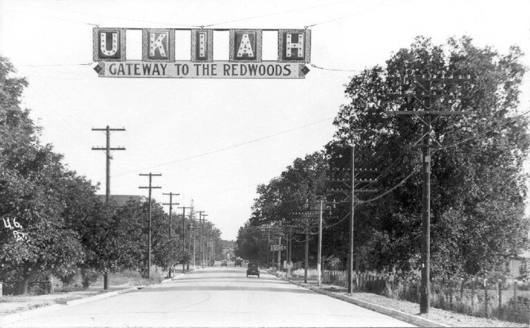
This branding effort was aimed at attracting automobile-based tourism and positioned Ukiah, along with similar communities, as an entry point to natural and recreational destinations.
By the mid-1990s, the City formalized its approach to gateways through adoption of the 1995 Ukiah Valley General Plan and Growth Management Program (1995 General Plan). This plan established a more structured, policy-driven framework and identified two distinct gateway types. The first level consisted of regional entry points into the Ukiah Valley, generally associated with major highway approaches. The second level focused on primary corridors leading into and through the city, recognizing that gateways function not only as points of entry but also as extended corridor experiences. These second-level gateways identified nearly all major city streets, including North State Street, South State Street, Perkins Street, Gobbi Street, Talmage Road, and Low Gap Road.
The 1995 General Plan emphasized preservation of the Ukiah Valley’s rural and bucolic visual character and highlighted the role of corridor design in shaping perceptions of the community. Gateway areas were identified as locations where development patterns, landscaping, signage, and roadway design should be coordinated to reinforce a cohesive visual identity.
To support these objectives, the plan included Implementation Measure CD-7.I(a), which called for use of redevelopment authority and other property improvement incentives to encourage reinvestment and aesthetic enhancement within gateway areas. Although redevelopment agencies have since been dissolved under California law, this measure reflects the City’s broader policy direction to use available public tools to support gateway improvements
Recent History
In 2012, Mendocino County adopted the Ukiah Valley Area Plan (UVAP). While the UVAP is a County planning document and does not establish City policy, it is derived from the City’s 1995 General Plan and provides useful context regarding the evolution of gateway concepts. The UVAP expanded on themes established in the 1995 General Plan, discussing gateways both as scenic entry points into the Ukiah Valley and as urban corridors leading into Ukiah. It reflects a continued shift toward understanding gateways as continuous experiences shaped by streetscape design, land use patterns, and visual continuity rather than as isolated points of arrival. Although some implementation tools referenced in the UVAP, such as redevelopment, are no longer available, the document illustrates the ongoing challenge of defining gateway locations and associated planning approaches.
Following adoption of the City’s Downtown Zoning Code in 2012, the City advanced many gateway-related design principles primarily through public infrastructure investments rather than new regulatory requirements for private property. During this period, several corridor studies and plans were prepared that addressed gateway concepts but were not fully implemented. Notably, the 2015 Perkins Street Gateway Master Plan proposed design strategies to reinforce Perkins Street as a major entry corridor. While the Master Plan itself was not fully realized, many of its concepts informed later City public works projects. In subsequent years, the City implemented the State Street Streetscape Project (Phases 1 and 2) and the Urban Core Rehabilitation Project along key corridors, including Perkins Street, Gobbi Street, and Main Street.
These projects introduced coordinated public realm improvements such as widened sidewalks, landscaped medians, street trees, pedestrian-scale lighting, street furniture, and roadway design treatments. Collectively, these investments improved walkability, pedestrian safety, and visual cohesion, reinforcing corridor identity and functioning as gateway improvements without imposing new development standards on adjacent private parcels
Existing Regional Gateway Locations
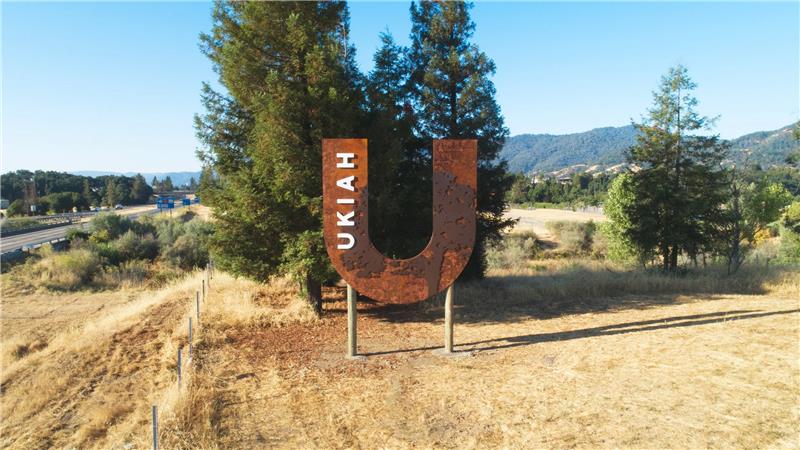
In May 2023, the City supported installation of two rust-colored, U-shaped gateway signs that replaced previous “Welcome to Ukiah” signage. One sign is located at the northern entrance to the city on private property, and the second is located near the southern entrance at Rivino Vineyards, both in unincorporated Mendocino County. Funding for the project was reserved annually by Visit Ukiah and was transferred when Visit Ukiah merged with the Ukiah Chamber of Commerce and the Ukiah Main Street Program to form the Greater Ukiah Business and Tourism Alliance.
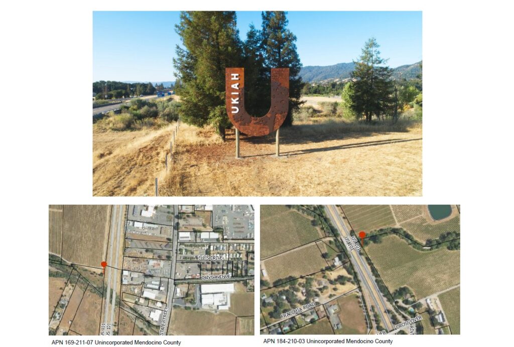
Although these signs are located outside City jurisdiction, they address the regional entry points into the Ukiah Valley identified in both the 1995 Ukiah Valley Growth Management Plan and the Ukiah Valley Area Plan. They also replace previous gateway signage that had become dated.
Proposed City Gateway Locations
To address the 2040 General Plan Land Use policy, Staff recommend designating three east-west corridors (Talmage Road, Gobbi Street, and Perkins Street) as locations for second-level city gateway features. Key intersections at Orchard Avenue and Airport Park Boulevard are also identified within these corridors.
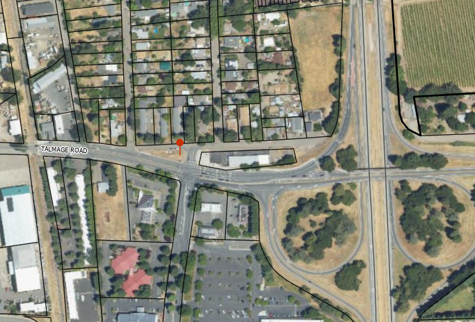
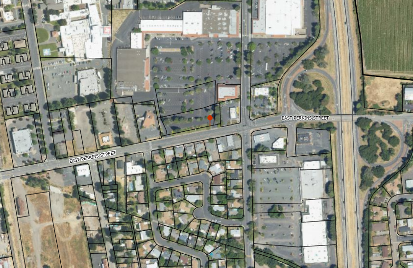
These streets were selected because they serve as primary entry points into the City’s long-standing street grid, and Gobbi and Perkins Streets have recently been the focus of public investment. The identified gateway locations are conceptual in nature; final placement, design, and extent of features will depend on site conditions, funding, infrastructure constraints, safety considerations, and coordination with future capital improvement projects.
Under this approach, gateway monuments consistent with City Council Resolution 2026-0015 would be installed as part of future corridor or capital improvement projects, drawing from recent Public Works efforts including the Streetscape program. No new development regulations or private parcel requirements are proposed.
However, the adopted resolution states that future public or private projects in the immediate vicinity of identified gateway locations should avoid features that interfere with, obscure, or visually compete with established gateway signage and design elements. These standards would be applied during discretionary permit review, such as Site Development or Use Permits.
Planning Commission (New Business) - 01-28-26
Planning Commission (Unfinished Business) - 03-11-26
City Council - 04-01-2025 (Resolution Adoption)
Summary: At their regular meeting on April 1, 2025, the City Council adopted the updated resolution and recommendations from the Planning Commission. Council encouraged and advised staff to coordinate across departments, particularly between Public Works, Community Services, and Community Development.
Post Adoption
Summary: Following City Council adoption of the resolution, Staff will seek opportunities to incorporate these gateway standards into future public art projects, monument selection, and corridor updates throughout the city, particularly for Talmage Road and Perkins Street. Additionally, staff will utilize this resolution to advance art and landscaping efforts along Gobbi Street.