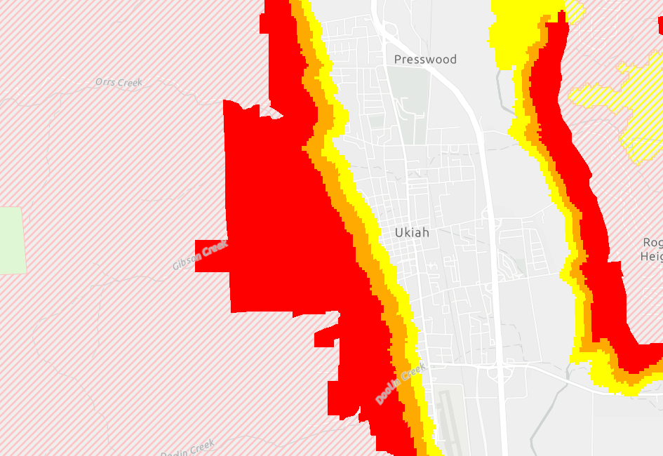
2/24/25: CAL FIRE Releases Updated Fire Hazard Severity Zone Maps for the City of Ukiah Local Responsibility Area
What are Fire Hazard Severity Zones?
State law requires the Office of the State Fire Marshal (OSFM) to classify lands within State Responsibility Areas into Fire Hazard Severity Zones and transmit maps of those zones to cities with jurisdictions over the zones (Local Responsibility Areas). The OSFM is to identify areas in the state as Moderate, High, and Very High Fire Hazard Severity Zones consistent with statewide criteria and based on the severity of fire hazard that is expected to prevail in those areas.
View the new Maps here (link).
The Fire Hazard Severity Zone maps are created by the California Department of Forestry and Fire Protection (CAL FIRE) under the direction of the OSFM. Local agencies such as the City of Ukiah do not control the creation of the maps but are required to ensure the community has the opportunity to review and provide feedback.
How might Fire Hazard Severity Zones affect property owners?
State law through SB 63 requires that the State Fire Marshal and the California Department of Housing and Community Development extend certain building standards and Wildland Urban Interface (WUI) regulations for Very High Fire Hazard Severity Zones. Such regulations require compliance with defensible space standards and WUI regulations.
What are Next Steps in the Process?
California Government Code Section 51179(a) requires that “A local agency shall designate, by ordinance, Moderate, High, and Very High Fire Hazard Severity Zones in its jurisdiction within 120 days of receiving recommendations from the State Fire Marshal pursuant to Section 51178.” Local governments cannot adopt a map version lowering the threat.
If you have questions about the maps and/or the mapping process, please contact the OSFM at FHSZinformation@fire.ca.gov or by calling (916) 633-7655.
Submit Public Comment
The 90-day public comment period opened 2/24/25. You may make comments in person, via email, or by calling the number below:
- In person: Community Development Dept. Counter, 300 Seminary Ave. Ukiah
- Email: planningdivision@cityofukiah.com
- Phone: Craig Schlatter, Community Development Director, at (707) 463-6219


